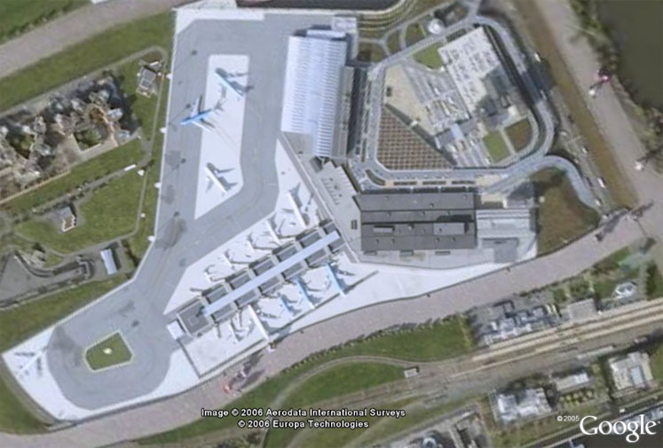
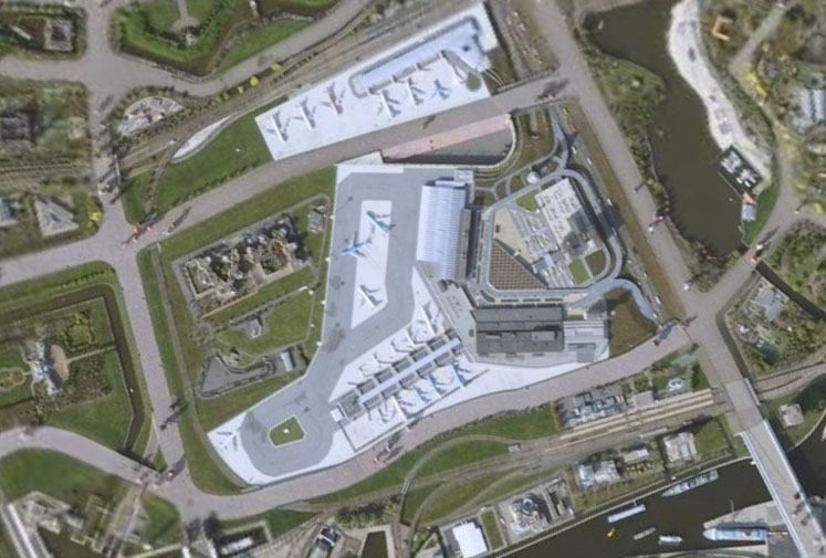
Dan Hadad emailed me this Google Earth Super-Ultra-Mega zoom location. It’s Google’s latest show-off for the new Mega Zoom locations. They illustrated it by showing high res aerial photo of an airport located near Den Hague in Netherlands. If you look at the picture below, you’ll probably ask yourself: “OK, what’s so high res about it?”. Well, if you look closely below the airplanes, you will notice what looks like huge people walking by. What you are really seeing are normal sized people walking by part of a miniature version of Holland which is a tourist attraction called “Madurodam”. Check it out in Google Earth or visit this Google Maps link. This aerial imagery is about 3 inches per pixel. Jump inside this article for more images. If you like Google Earth optical illusions, don’t forget to check more of them in this category!


Only Chuck Norris is really that tall.
not so mega … can’t see boobies on the beach
Guess you really ARE a pervert.
Veggies is a pervert because when people criticize they only can reflect themselves from within.
To think Boobs should not be seen its a crime to cover nice ones up.
I knew what you meant as I remember a set getting tan on a roof top there as well.
It’s in holland, im from holland, its madurodam, a park where they build the world in miniature….
bigAL
=O
that’s pretty
frickin coooool!
you can look for “Catalunya en miniatura” (Catalonia in miniature). It’s a similar atraction, AFAIK it’s also outdoors and maybe you can locate it.
gullivers kingdom derbyshire england
wait is that showing that people who live in the Netherlands are giants, there bigger that fricken airplains
They’re not people, they’re SPACE ALIENS!!!
The first thing I thought was, “Where’s the runway?”
It’s Den Haag.. Or ‘s-Gravenhage..! And well i know that because i’m there now.. ^^ .. Really nice city ^^..
*facepalm*
Where did YOU learned your English?
It’s called “The Hague” in English!
“Den Haag” is Dutch! -.-“
wow. Since i have google earth, where did u see that?
Awsome! I hope they get pictures of that quality for where I am soon.
that’s really kewl.
if you have google earh look around the airport and almost every ones gaint
Chuck Norris, Shaq, and that really tall Asian basketball player.
I’m from the Netherlands,
Madurodam isn’t that cool…
Mini-Holland, hmmm
cool
No, Collosus is that big…… or a giant mutant bunny rabit
I saw it
chuck norris and flaming ninja flamingos are the onlys ones who cant fit in an airplane
its kinda weird
its madurodam in holland
its holland in miniature…. not so special
im from holland and i stood next to the planes pretty cool place makes you feel like goddzilla
i really don get it
i dont see any optical illusion